
Dolomites · 1,267 km · 81 days
Via Alpina
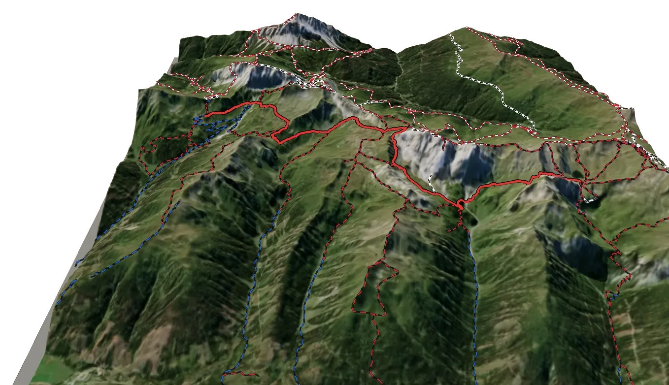
A 81-day trek of 1,267 km in the Dolomites area, with 84,911 m of climbing.
Overview
About Via Alpina
Via Alpina is an international long-distance trail in the Dolomites area, crossing Switzerland, Italy and France. It runs 1,267.0 km from Porzehütte Karnischer Hauptkamm to the finish. Along the way you climb 84,911 m and descend 84,729 m, between 354 m and a high point of 2,799 m. At a steady pace it takes about 603 h 20 of walking, usually split over 81 days. The hardest section is graded T3 on the Swiss hiking scale, demanding mountain hiking: a demanding path with steep, exposed sections and sometimes hands needed for balance; sure-footedness required. Most of it is easier, around T2. It is waymarked and looked after by via-alpina.org. 12 mountain huts are right on the route, so there are places to eat and sleep on the way. It passes over Schöntalspitze - Cima di Valbella, Demutspitze - La Muta and Stoßkofel.
On the trail
81 stages
Hard
Via Alpina Red R24
Porzehütte Karnischer Hauptkamm → Obstanserseehütte
12 km · 7 h 20
From Porzehütte Karnischer Hauptkamm to Obstanserseehütte. The day ends at Obstanserseehütte, a mountain hut: book ahead in summer.
- Distance
- 12.3 km
- Ascent
- +1,289 m
- Descent
- −923 m
- Walking time
- 7 h 20
- Highest point
- 2,483 m
- Lowest point
- 1,911 m
Medium
Via Alpina Red R25
Obstanserseehütte → Sillianer Hütte
8 km · 3 h 40
From Obstanserseehütte to Sillianer Hütte. The day ends at Sillianer Hütte, a mountain hut: book ahead in summer.
- Distance
- 8.5 km
- Ascent
- +562 m
- Descent
- −416 m
- Walking time
- 3 h 40
- Highest point
- 2,646 m
- Lowest point
- 2,302 m
Hard
The route
Sillianer Hütte → Dreizinnenhutte
18 km · 8 h
From Sillianer Hütte to Dreizinnenhutte. The day ends at Dreizinnenhutte, a mountain hut: book ahead in summer.
- Distance
- 17.9 km
- Ascent
- +1,157 m
- Descent
- −1,194 m
- Walking time
- 8 h
- Highest point
- 2,443 m
- Lowest point
- 1,312 m
Hard
Via Alpina Red R27
Dreizinnenhutte → Dürrensteinhütte
14 km · 7 h
From Dreizinnenhutte to Dürrensteinhütte. The day ends at Dürrensteinhütte, a mountain hut: book ahead in summer.
- Distance
- 14.2 km
- Ascent
- +909 m
- Descent
- −1,278 m
- Walking time
- 7 h
- Highest point
- 2,402 m
- Lowest point
- 1,404 m
Medium
Via Alpina Red R28
Dürrensteinhütte → Rifugio Biella Seekofelhütte
13 km · 5 h 05
From Dürrensteinhütte to Rifugio Biella Seekofelhütte. The day ends at Rifugio Biella Seekofelhütte, a mountain hut: book ahead in summer.
- Distance
- 13.3 km
- Ascent
- +800 m
- Descent
- −505 m
- Walking time
- 5 h 05
- Highest point
- 2,370 m
- Lowest point
- 1,959 m
Hard
Via Alpina Red R29
Rifugio Biella Seekofelhütte → St. Martin - San Martino in Casies
29 km · 9 h 10
From Rifugio Biella Seekofelhütte to St. Martin - San Martino in Casies.
- Distance
- 29.0 km
- Ascent
- +509 m
- Descent
- −1,547 m
- Walking time
- 9 h 10
- Highest point
- 2,378 m
- Lowest point
- 1,093 m
Hard
Via Alpina Red R30
St. Martin - San Martino in Casies → Antholz Mittertal - Anterselva di Mezzo
15 km · 7 h 40
From St. Martin - San Martino in Casies to Antholz Mittertal - Anterselva di Mezzo.
- Distance
- 15.2 km
- Ascent
- +1,147 m
- Descent
- −1,195 m
- Walking time
- 7 h 40
- Highest point
- 2,389 m
- Lowest point
- 1,240 m
Hard
Via Alpina Red R31
Antholz Mittertal - Anterselva di Mezzo → the trail above Antholz Mittertal - Anterselva di Mezzo
6 km · 5 h 25
From Antholz Mittertal - Anterselva di Mezzo to the trail above Antholz Mittertal - Anterselva di Mezzo.
- Distance
- 6.2 km
- Ascent
- +1,495 m
- Descent
- −0 m
- Walking time
- 5 h 25
- Highest point
- 2,794 m
- Lowest point
- 1,299 m
Hard
Via Alpina Red R32
the trail above Antholz Mittertal - Anterselva di Mezzo → Ahornach - Acereto
18 km · 7 h 25
From the trail above Antholz Mittertal - Anterselva di Mezzo to Ahornach - Acereto.
- Distance
- 17.9 km
- Ascent
- +473 m
- Descent
- −1,899 m
- Walking time
- 7 h 25
- Highest point
- 2,800 m
- Lowest point
- 1,371 m
Hard
Via Alpina Red R33
Ahornach - Acereto → the trail above Oberlappach - Lappago di Sopra
25 km · 11 h
From Ahornach - Acereto to the trail above Oberlappach - Lappago di Sopra.
- Distance
- 25.2 km
- Ascent
- +2,000 m
- Descent
- −906 m
- Walking time
- 11 h
- Highest point
- 2,438 m
- Lowest point
- 937 m
Medium
Via Alpina Red R34
the trail above Oberlappach - Lappago di Sopra → the trail above Pfunders - Fundres
14 km · 6 h 50
From the trail above Oberlappach - Lappago di Sopra to the trail above Pfunders - Fundres.
- Distance
- 13.6 km
- Ascent
- +690 m
- Descent
- −1,538 m
- Walking time
- 6 h 50
- Highest point
- 2,538 m
- Lowest point
- 1,567 m
Hard
Via Alpina Red R35
the trail above Pfunders - Fundres → the trail above St. Jakob - San Giacomo
16 km · 9 h
From the trail above Pfunders - Fundres to the trail above St. Jakob - San Giacomo.
- Distance
- 15.5 km
- Ascent
- +1,679 m
- Descent
- −966 m
- Walking time
- 9 h
- Highest point
- 2,632 m
- Lowest point
- 1,534 m
Medium
Via Alpina Red R36
the trail above St. Jakob - San Giacomo → the trail near Ginzling
16 km · 5 h 05
From the trail above St. Jakob - San Giacomo to the trail near Ginzling.
- Distance
- 15.8 km
- Ascent
- +41 m
- Descent
- −1,233 m
- Walking time
- 5 h 05
- Highest point
- 2,246 m
- Lowest point
- 1,054 m
Medium
Via Alpina Red R37
the trail near Ginzling → Finkenberg
6 km · 2 h 30
From the trail near Ginzling to Finkenberg.
- Distance
- 6.5 km
- Ascent
- +296 m
- Descent
- −415 m
- Walking time
- 2 h 30
- Highest point
- 1,009 m
- Lowest point
- 845 m
Hard
Via Alpina Red R38
Finkenberg → Rastkogelhütte
18 km · 8 h 55
From Finkenberg to Rastkogelhütte. The day ends at Rastkogelhütte, a mountain hut: book ahead in summer.
- Distance
- 18.4 km
- Ascent
- +1,869 m
- Descent
- −596 m
- Walking time
- 8 h 55
- Highest point
- 2,114 m
- Lowest point
- 841 m
Medium
Via Alpina Red R39
Rastkogelhütte → Kellerjochhütte
14 km · 5 h 35
From Rastkogelhütte to Kellerjochhütte. The day ends at Kellerjochhütte, a mountain hut: book ahead in summer.
- Distance
- 13.5 km
- Ascent
- +832 m
- Descent
- −726 m
- Walking time
- 5 h 35
- Highest point
- 2,222 m
- Lowest point
- 1,598 m
Medium
Via Alpina Red R40
Kellerjochhütte → the trail near Kolsassberg
11 km · 5 h 30
From Kellerjochhütte to the trail near Kolsassberg.
- Distance
- 11.2 km
- Ascent
- +160 m
- Descent
- −1,841 m
- Walking time
- 5 h 30
- Highest point
- 2,234 m
- Lowest point
- 545 m
Hard
Via Alpina Red R41
the trail near Kolsassberg → Lamsenjochhütte
12 km · 6 h 05
From the trail near Kolsassberg to Lamsenjochhütte. The day ends at Lamsenjochhütte, a mountain hut: book ahead in summer.
- Distance
- 12.4 km
- Ascent
- +1,499 m
- Descent
- −94 m
- Walking time
- 6 h 05
- Highest point
- 1,948 m
- Lowest point
- 535 m
Medium
Via Alpina Red R42
Lamsenjochhütte → Falkenhütte
12 km · 5 h 55
From Lamsenjochhütte to Falkenhütte. The day ends at Falkenhütte, a mountain hut: book ahead in summer.
- Distance
- 11.6 km
- Ascent
- +861 m
- Descent
- −965 m
- Walking time
- 5 h 55
- Highest point
- 1,948 m
- Lowest point
- 1,221 m
Medium
Via Alpina Red R44
Falkenhütte → the trail near Seefeld in Tirol
11 km · 4 h 05
From Falkenhütte to the trail near Seefeld in Tirol.
- Distance
- 10.7 km
- Ascent
- +665 m
- Descent
- −430 m
- Walking time
- 4 h 05
- Highest point
- 1,492 m
- Lowest point
- 964 m
Medium
Via Alpina Red R46
the trail near Seefeld in Tirol → the trail above Barwies
10 km · 4 h 20
From the trail near Seefeld in Tirol to the trail above Barwies.
- Distance
- 9.8 km
- Ascent
- +587 m
- Descent
- −682 m
- Walking time
- 4 h 20
- Highest point
- 2,117 m
- Lowest point
- 1,569 m
Medium
Via Alpina Red R47
the trail above Barwies → Wolfratshauserhütte
11 km · 6 h 10
From the trail above Barwies to Wolfratshauserhütte. The day ends at Wolfratshauserhütte, a mountain hut: book ahead in summer.
- Distance
- 10.7 km
- Ascent
- +920 m
- Descent
- −1,085 m
- Walking time
- 6 h 10
- Highest point
- 1,999 m
- Lowest point
- 985 m
Medium
Via Alpina Red R50
Wolfratshauserhütte → the trail near Hinterhornbach
17 km · 6 h 35
From Wolfratshauserhütte to the trail near Hinterhornbach.
- Distance
- 17.3 km
- Ascent
- +502 m
- Descent
- −1,515 m
- Walking time
- 6 h 35
- Highest point
- 2,003 m
- Lowest point
- 830 m
Hard
Via Alpina Red R51
the trail near Hinterhornbach → the trail above Warth
17 km · 6 h 55
From the trail near Hinterhornbach to the trail above Warth.
- Distance
- 16.7 km
- Ascent
- +1,481 m
- Descent
- −292 m
- Walking time
- 6 h 55
- Highest point
- 2,020 m
- Lowest point
- 831 m
Medium
The route
the trail above Warth → Weisstannen
11 km · 4 h 30
From the trail above Warth to Weisstannen.
- Distance
- 10.9 km
- Ascent
- +853 m
- Descent
- −368 m
- Walking time
- 4 h 30
- Highest point
- 1,067 m
- Lowest point
- 488 m
Hard
The route
Weisstannen → Elm
20 km · 8 h 55
From Weisstannen to Elm.
- Distance
- 19.7 km
- Ascent
- +1,351 m
- Descent
- −1,302 m
- Walking time
- 8 h 55
- Highest point
- 2,216 m
- Lowest point
- 1,003 m
Hard
The route
Elm → Linthal
22 km · 11 h 05
From Elm to Linthal.
- Distance
- 22.2 km
- Ascent
- +1,564 m
- Descent
- −1,901 m
- Walking time
- 11 h 05
- Highest point
- 2,251 m
- Lowest point
- 663 m
Medium
The route
Linthal → Urnerboden
14 km · 5 h 10
From Linthal to Urnerboden.
- Distance
- 14.0 km
- Ascent
- +989 m
- Descent
- −297 m
- Walking time
- 5 h 10
- Highest point
- 1,482 m
- Lowest point
- 669 m
Hard
The route
Urnerboden → Bürglen UR
25 km · 9 h
From Urnerboden to Bürglen UR.
- Distance
- 25.3 km
- Ascent
- +861 m
- Descent
- −1,727 m
- Walking time
- 9 h
- Highest point
- 1,950 m
- Lowest point
- 498 m
Hard
The route
Bürglen UR → Engelberg
28 km · 11 h 45
From Bürglen UR to Engelberg.
- Distance
- 27.7 km
- Ascent
- +1,936 m
- Descent
- −1,400 m
- Walking time
- 11 h 45
- Highest point
- 2,269 m
- Lowest point
- 450 m
Medium
The route
Engelberg → Rossbodenhütte Engstlenalp
12 km · 6 h
From Engelberg to Rossbodenhütte Engstlenalp. The day ends at Rossbodenhütte Engstlenalp, a mountain hut: book ahead in summer.
- Distance
- 11.7 km
- Ascent
- +1,251 m
- Descent
- −415 m
- Walking time
- 6 h
- Highest point
- 2,210 m
- Lowest point
- 1,002 m
Hard
The route
Rossbodenhütte Engstlenalp → Meiringen
20 km · 8 h 05
From Rossbodenhütte Engstlenalp to Meiringen.
- Distance
- 19.5 km
- Ascent
- +650 m
- Descent
- −1,872 m
- Walking time
- 8 h 05
- Highest point
- 2,239 m
- Lowest point
- 614 m
Hard
The route
Meiringen → Grindelwald
20 km · 8 h 20
From Meiringen to Grindelwald.
- Distance
- 19.5 km
- Ascent
- +1,417 m
- Descent
- −921 m
- Walking time
- 8 h 20
- Highest point
- 1,959 m
- Lowest point
- 600 m
Hard
The route
Grindelwald → Lauterbrunnen
17 km · 7 h 40
From Grindelwald to Lauterbrunnen.
- Distance
- 16.6 km
- Ascent
- +1,042 m
- Descent
- −1,283 m
- Walking time
- 7 h 40
- Highest point
- 2,061 m
- Lowest point
- 790 m
Hard
The route
Lauterbrunnen → the trail above Kiental
21 km · 11 h
From Lauterbrunnen to the trail above Kiental.
- Distance
- 21.2 km
- Ascent
- +1,912 m
- Descent
- −1,315 m
- Walking time
- 11 h
- Highest point
- 2,605 m
- Lowest point
- 801 m
Hard
The route
the trail above Kiental → Kandersteg
16 km · 9 h 40
From the trail above Kiental to Kandersteg.
- Distance
- 16.4 km
- Ascent
- +1,430 m
- Descent
- −1,665 m
- Walking time
- 9 h 40
- Highest point
- 2,769 m
- Lowest point
- 1,176 m
Hard
The route
Kandersteg → the trail near Adelboden
12 km · 7 h 05
From Kandersteg to the trail near Adelboden.
- Distance
- 12.5 km
- Ascent
- +1,171 m
- Descent
- −1,039 m
- Walking time
- 7 h 05
- Highest point
- 2,335 m
- Lowest point
- 1,179 m
Medium
The route
the trail near Adelboden → Lenk
12 km · 5 h 05
From the trail near Adelboden to Lenk.
- Distance
- 12.0 km
- Ascent
- +660 m
- Descent
- −859 m
- Walking time
- 5 h 05
- Highest point
- 1,949 m
- Lowest point
- 1,128 m
Medium
Via Alpina Stage 73: Lenk - Lauenen
Lenk → Lauenen
13 km · 6 h 10
From Lenk to Lauenen.
- Distance
- 13.0 km
- Ascent
- +985 m
- Descent
- −825 m
- Walking time
- 6 h 10
- Highest point
- 2,054 m
- Lowest point
- 1,084 m
Medium
Via Alpina Red R103
Lauenen → Gsteig b. Gstaad
7 km · 3 h
From Lauenen to Gsteig b. Gstaad.
- Distance
- 6.7 km
- Ascent
- +420 m
- Descent
- −488 m
- Walking time
- 3 h
- Highest point
- 1,657 m
- Lowest point
- 1,171 m
Hard
Via Alpina Red R104
Gsteig b. Gstaad → the trail near Glarey
18 km · 8 h 20
From Gsteig b. Gstaad to the trail near Glarey.
- Distance
- 18.0 km
- Ascent
- +1,309 m
- Descent
- −1,110 m
- Walking time
- 8 h 20
- Highest point
- 2,311 m
- Lowest point
- 1,221 m
Medium
Via Alpina Stage 76: Auberge du Godey - Anzeinde
the trail near Glarey → the trail above Les Plans-sur-Bex
9 km · 3 h 50
From the trail near Glarey to the trail above Les Plans-sur-Bex.
- Distance
- 8.6 km
- Ascent
- +755 m
- Descent
- −293 m
- Walking time
- 3 h 50
- Highest point
- 2,038 m
- Lowest point
- 1,420 m
Hard
Via Alpina Stage 77: Anzeinde - Col du Demècre
the trail above Les Plans-sur-Bex → Cabane du Demècre
24 km · 12 h 35
From the trail above Les Plans-sur-Bex to Cabane du Demècre. The day ends at Cabane du Demècre, a mountain hut: book ahead in summer.
- Distance
- 23.5 km
- Ascent
- +2,126 m
- Descent
- −1,651 m
- Walking time
- 12 h 35
- Highest point
- 2,601 m
- Lowest point
- 1,247 m
Medium
Via Alpina Stage 78: Col du Demècre - Vernayaz
Cabane du Demècre → Vernayaz
14 km · 6 h 25
From Cabane du Demècre to Vernayaz.
- Distance
- 13.9 km
- Ascent
- +188 m
- Descent
- −2,091 m
- Walking time
- 6 h 25
- Highest point
- 2,453 m
- Lowest point
- 454 m
Medium
Via Alpina Stage 79: Vernayaz - Trient
Vernayaz → Trient
12 km · 5 h 05
From Vernayaz to Trient.
- Distance
- 11.5 km
- Ascent
- +1,082 m
- Descent
- −274 m
- Walking time
- 5 h 05
- Highest point
- 1,268 m
- Lowest point
- 460 m
Hard
Via Alpina Stage 80: Trient - Champex-Lac
Trient → Champex-Lac
14 km · 8 h 25
From Trient to Champex-Lac.
- Distance
- 14.1 km
- Ascent
- +1,407 m
- Descent
- −1,249 m
- Walking time
- 8 h 25
- Highest point
- 2,652 m
- Lowest point
- 1,312 m
Medium
Via Alpina Stage 81: Champex-Lac - Bourg St. Pierre
Champex-Lac → Bourg-Saint-Pierre
15 km · 6 h
From Champex-Lac to Bourg-Saint-Pierre.
- Distance
- 15.0 km
- Ascent
- +916 m
- Descent
- −759 m
- Walking time
- 6 h
- Highest point
- 1,633 m
- Lowest point
- 895 m
Medium
Via Alpina Red R116
Bourg-Saint-Pierre → the trail above Saint-Rhémy-en-Bosses
11 km · 4 h 55
From Bourg-Saint-Pierre to the trail above Saint-Rhémy-en-Bosses.
- Distance
- 11.3 km
- Ascent
- +1,022 m
- Descent
- −197 m
- Walking time
- 4 h 55
- Highest point
- 2,473 m
- Lowest point
- 1,601 m
Hard
Via Alpina Red R117
the trail above Saint-Rhémy-en-Bosses → Avise
26 km · 11 h 10
From the trail above Saint-Rhémy-en-Bosses to Avise.
- Distance
- 26.5 km
- Ascent
- +1,112 m
- Descent
- −2,310 m
- Walking time
- 11 h 10
- Highest point
- 2,483 m
- Lowest point
- 1,276 m
Hard
Via Alpina Red R118
Avise → Valgrisenche
19 km · 8 h 20
From Avise to Valgrisenche.
- Distance
- 19.0 km
- Ascent
- +1,389 m
- Descent
- −986 m
- Walking time
- 8 h 20
- Highest point
- 1,758 m
- Lowest point
- 753 m
Hard
Via Alpina Red R119
Valgrisenche → Refuge de l'Archeboc
18 km · 10 h 50
From Valgrisenche to Refuge de l'Archeboc. The day ends at Refuge de l'Archeboc, a mountain hut: book ahead in summer.
- Distance
- 18.1 km
- Ascent
- +1,803 m
- Descent
- −1,440 m
- Walking time
- 10 h 50
- Highest point
- 2,677 m
- Lowest point
- 1,666 m
Medium
Via Alpina Red R120
Refuge de l'Archeboc → the trail above Sainte-Foy-Tarentaise
12 km · 4 h 25
From Refuge de l'Archeboc to the trail above Sainte-Foy-Tarentaise.
- Distance
- 12.2 km
- Ascent
- +520 m
- Descent
- −676 m
- Walking time
- 4 h 25
- Highest point
- 2,032 m
- Lowest point
- 1,702 m
Medium
Via Alpina Red R121
the trail above Sainte-Foy-Tarentaise → Tignes
14 km · 5 h 45
From the trail above Sainte-Foy-Tarentaise to Tignes.
- Distance
- 14.4 km
- Ascent
- +875 m
- Descent
- −655 m
- Walking time
- 5 h 45
- Highest point
- 2,136 m
- Lowest point
- 1,740 m
Medium
Via Alpina Red R122
Tignes → Refuge de la Leisse
12 km · 4 h 10
From Tignes to Refuge de la Leisse. The day ends at Refuge de la Leisse, a mountain hut: book ahead in summer.
- Distance
- 11.5 km
- Ascent
- +682 m
- Descent
- −287 m
- Walking time
- 4 h 10
- Highest point
- 2,747 m
- Lowest point
- 2,086 m
Medium
Via Alpina Red R123
Refuge de la Leisse → Termignon
20 km · 6 h 50
From Refuge de la Leisse to Termignon.
- Distance
- 19.7 km
- Ascent
- +383 m
- Descent
- −1,569 m
- Walking time
- 6 h 50
- Highest point
- 2,485 m
- Lowest point
- 1,292 m
Medium
Via Alpina Red R124
Termignon → Modane
18 km · 5 h 45
From Termignon to Modane.
- Distance
- 18.0 km
- Ascent
- +515 m
- Descent
- −676 m
- Walking time
- 5 h 45
- Highest point
- 1,395 m
- Lowest point
- 1,152 m
Hard
Via Alpina Red R125
Modane → Refuge Terzo Alpini
19 km · 7 h 55
From Modane to Refuge Terzo Alpini. The day ends at Refuge Terzo Alpini, a mountain hut: book ahead in summer.
- Distance
- 18.9 km
- Ascent
- +1,387 m
- Descent
- −705 m
- Walking time
- 7 h 55
- Highest point
- 2,441 m
- Lowest point
- 1,093 m
Medium
Via Alpina Red R126
Refuge Terzo Alpini → Roubion
8 km · 3 h 25
From Refuge Terzo Alpini to Roubion.
- Distance
- 8.0 km
- Ascent
- +417 m
- Descent
- −583 m
- Walking time
- 3 h 25
- Highest point
- 2,191 m
- Lowest point
- 1,612 m
Hard
Via Alpina Red R127
Roubion → Le Monêtier-les-Bains
16 km · 7 h 05
From Roubion to Le Monêtier-les-Bains.
- Distance
- 16.0 km
- Ascent
- +966 m
- Descent
- −1,084 m
- Walking time
- 7 h 05
- Highest point
- 2,427 m
- Lowest point
- 1,482 m
Hard
Via Alpina Red R128
Le Monêtier-les-Bains → Saint-Antoine
16 km · 7 h 10
From Le Monêtier-les-Bains to Saint-Antoine.
- Distance
- 16.3 km
- Ascent
- +965 m
- Descent
- −1,137 m
- Walking time
- 7 h 10
- Highest point
- 2,425 m
- Lowest point
- 1,296 m
Hard
Via Alpina Red R129
Saint-Antoine → Freissinières
20 km · 8 h 25
From Saint-Antoine to Freissinières.
- Distance
- 20.4 km
- Ascent
- +1,235 m
- Descent
- −1,173 m
- Walking time
- 8 h 25
- Highest point
- 1,848 m
- Lowest point
- 1,086 m
Medium
Via Alpina Red R130
Freissinières → Mont-Dauphin
18 km · 6 h 05
From Freissinières to Mont-Dauphin.
- Distance
- 18.0 km
- Ascent
- +610 m
- Descent
- −908 m
- Walking time
- 6 h 05
- Highest point
- 1,592 m
- Lowest point
- 888 m
Medium
Via Alpina Red R131
Mont-Dauphin → Refuge De Furfande
12 km · 5 h 15
From Mont-Dauphin to Refuge De Furfande. The day ends at Refuge De Furfande, a mountain hut: book ahead in summer.
- Distance
- 11.6 km
- Ascent
- +1,126 m
- Descent
- −218 m
- Walking time
- 5 h 15
- Highest point
- 2,292 m
- Lowest point
- 1,384 m
Hard
Via Alpina Red R132
Refuge De Furfande → Ceillac
16 km · 8 h 30
From Refuge De Furfande to Ceillac.
- Distance
- 16.0 km
- Ascent
- +1,063 m
- Descent
- −1,693 m
- Walking time
- 8 h 30
- Highest point
- 2,290 m
- Lowest point
- 1,188 m
Medium
Via Alpina Red R133
Ceillac → Chalet Refuge Caf Maljasset
13 km · 6 h 45
From Ceillac to Chalet Refuge Caf Maljasset. The day ends at Chalet Refuge Caf Maljasset, a mountain hut: book ahead in summer.
- Distance
- 13.2 km
- Ascent
- +1,109 m
- Descent
- −838 m
- Walking time
- 6 h 45
- Highest point
- 2,693 m
- Lowest point
- 1,638 m
Medium
Via Alpina Red R134
Chalet Refuge Caf Maljasset → the trail above Acceglio
12 km · 5 h 15
From Chalet Refuge Caf Maljasset to the trail above Acceglio.
- Distance
- 12.2 km
- Ascent
- +741 m
- Descent
- −724 m
- Walking time
- 5 h 15
- Highest point
- 2,640 m
- Lowest point
- 1,909 m
Medium
Via Alpina Red R135
the trail above Acceglio → the trail above Acceglio
11 km · 4 h 30
From the trail above Acceglio to the trail above Acceglio.
- Distance
- 11.1 km
- Ascent
- +719 m
- Descent
- −471 m
- Walking time
- 4 h 30
- Highest point
- 2,199 m
- Lowest point
- 1,565 m
Medium
Via Alpina Red R136
the trail above Acceglio → Pontebernardo
16 km · 6 h 55
From the trail above Acceglio to Pontebernardo.
- Distance
- 15.5 km
- Ascent
- +799 m
- Descent
- −1,317 m
- Walking time
- 6 h 55
- Highest point
- 2,607 m
- Lowest point
- 1,325 m
Hard
Via Alpina Red R137
Pontebernardo → Rifugio Ervedo Zanotti
20 km · 11 h 45
From Pontebernardo to Rifugio Ervedo Zanotti. The day ends at Rifugio Ervedo Zanotti, a mountain hut: book ahead in summer.
- Distance
- 19.5 km
- Ascent
- +2,167 m
- Descent
- −1,347 m
- Walking time
- 11 h 45
- Highest point
- 2,496 m
- Lowest point
- 1,325 m
Hard
Via Alpina Red R138
Rifugio Ervedo Zanotti → Bagni di Vinadio
14 km · 7 h 20
From Rifugio Ervedo Zanotti to Bagni di Vinadio.
- Distance
- 13.5 km
- Ascent
- +789 m
- Descent
- −1,642 m
- Walking time
- 7 h 20
- Highest point
- 2,537 m
- Lowest point
- 1,295 m
Medium
Via Alpina Red R139
Bagni di Vinadio → the trail above Bagni di Vinadio
8 km · 5 h 05
From Bagni di Vinadio to the trail above Bagni di Vinadio.
- Distance
- 8.5 km
- Ascent
- +1,096 m
- Descent
- −352 m
- Walking time
- 5 h 05
- Highest point
- 2,304 m
- Lowest point
- 1,270 m
Medium
Via Alpina Red R140
the trail above Bagni di Vinadio → Rifugio Malinvern
13 km · 5 h 50
From the trail above Bagni di Vinadio to Rifugio Malinvern. The day ends at Rifugio Malinvern, a mountain hut: book ahead in summer.
- Distance
- 12.8 km
- Ascent
- +743 m
- Descent
- −977 m
- Walking time
- 5 h 50
- Highest point
- 2,591 m
- Lowest point
- 1,836 m
Medium
Via Alpina Red R141
Rifugio Malinvern → Rifugio Emilio Questa
8 km · 4 h 45
From Rifugio Malinvern to Rifugio Emilio Questa. The day ends at Rifugio Emilio Questa, a mountain hut: book ahead in summer.
- Distance
- 8.4 km
- Ascent
- +936 m
- Descent
- −409 m
- Walking time
- 4 h 45
- Highest point
- 2,521 m
- Lowest point
- 1,811 m
Medium
Via Alpina Red R142
Rifugio Emilio Questa → Rifugio Morelli Buzzi
15 km · 6 h 55
From Rifugio Emilio Questa to Rifugio Morelli Buzzi. The day ends at Rifugio Morelli Buzzi, a mountain hut: book ahead in summer.
- Distance
- 15.3 km
- Ascent
- +1,011 m
- Descent
- −1,017 m
- Walking time
- 6 h 55
- Highest point
- 2,356 m
- Lowest point
- 1,363 m
Medium
Via Alpina Red R143
Rifugio Morelli Buzzi → Rifugio Soria Ellena
14 km · 7 h
From Rifugio Morelli Buzzi to Rifugio Soria Ellena. The day ends at Rifugio Soria Ellena, a mountain hut: book ahead in summer.
- Distance
- 13.7 km
- Ascent
- +834 m
- Descent
- −1,360 m
- Walking time
- 7 h
- Highest point
- 2,549 m
- Lowest point
- 1,791 m
Medium
Via Alpina Red R144
Rifugio Soria Ellena → the trail above Saint-Martin-Vésubie
8 km · 4 h 10
From Rifugio Soria Ellena to the trail above Saint-Martin-Vésubie.
- Distance
- 7.6 km
- Ascent
- +660 m
- Descent
- −582 m
- Walking time
- 4 h 10
- Highest point
- 2,468 m
- Lowest point
- 1,812 m
Medium
Via Alpina Red R145
the trail above Saint-Martin-Vésubie → Refuge Nice
6 km · 3 h 50
From the trail above Saint-Martin-Vésubie to Refuge Nice. The day ends at Refuge Nice, a mountain hut: book ahead in summer.
- Distance
- 5.6 km
- Ascent
- +744 m
- Descent
- −427 m
- Walking time
- 3 h 50
- Highest point
- 2,537 m
- Lowest point
- 1,868 m
Medium
Via Alpina Stage 112 Refuge de Nice ou Victor de Cessole - Refuge Merveilles
Refuge Nice → Refuge des Merveilles
9 km · 4 h 30
From Refuge Nice to Refuge des Merveilles. The day ends at Refuge des Merveilles, a mountain hut: book ahead in summer.
- Distance
- 9.1 km
- Ascent
- +625 m
- Descent
- −717 m
- Walking time
- 4 h 30
- Highest point
- 2,682 m
- Lowest point
- 2,133 m
Medium
Via Alpina Stage 113: Refuge des Merveilles - Camp d’Argent
Refuge des Merveilles → the trail above Moulinet
13 km · 5 h 20
From Refuge des Merveilles to the trail above Moulinet.
- Distance
- 12.6 km
- Ascent
- +597 m
- Descent
- −971 m
- Walking time
- 5 h 20
- Highest point
- 2,432 m
- Lowest point
- 1,760 m
Hard
Via Alpina Stage 114: Camp d'Argent - Sospel
the trail above Moulinet → the trail near Moulinet
21 km · 7 h 45
From the trail above Moulinet to the trail near Moulinet.
- Distance
- 21.1 km
- Ascent
- +500 m
- Descent
- −1,888 m
- Walking time
- 7 h 45
- Highest point
- 1,932 m
- Lowest point
- 354 m
Medium
Via Alpina Red R160
the trail near Moulinet → 614 m on the route
13 km · 6 h 15
From the trail near Moulinet to 614 m on the route.
- Distance
- 13.3 km
- Ascent
- +1,028 m
- Descent
- −800 m
- Walking time
- 6 h 15
- Highest point
- 1,085 m
- Lowest point
- 386 m
Times are for a steady walker without long breaks, worked out like the atlas does from distance, climb and altitude. Swiss hiking scale: T1 hiking · T2 mountain hiking · T3 demanding mountain hiking · T4 alpine hiking · T5–T6 demanding alpine routes.
The 3D atlas
Walk Via Alpina before you go.
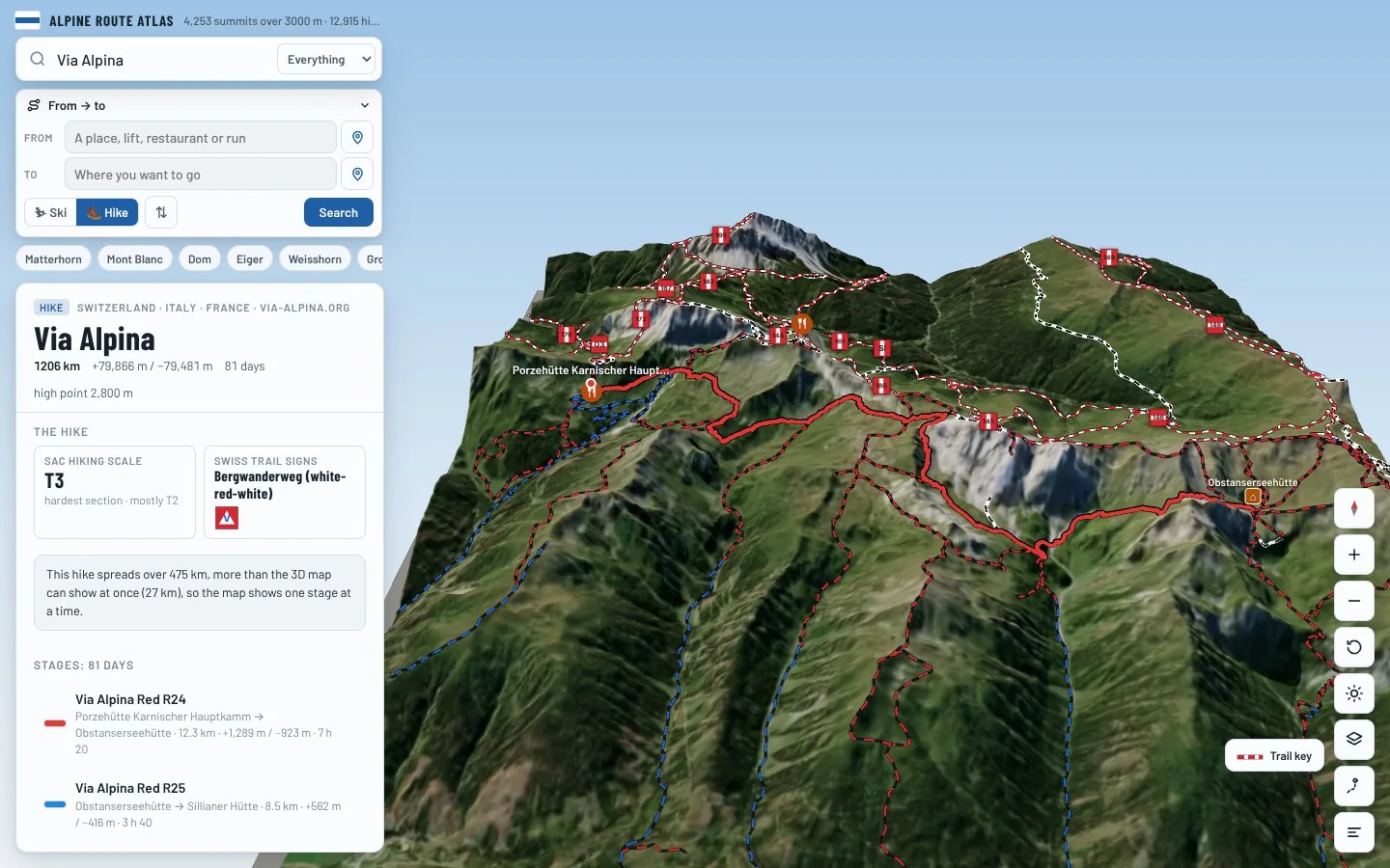
Follow every stage on real 3D terrain in Berg Explorer: see the climbs, the passes and the huts where each day ends.
- Turn and tilt every face in real 3D terrain
- Each route traced in colour, with its grade
- Huts, lifts and waymarked trails on the map
- Free, in your browser, no download
Where to stay
Huts on the route
Nearby
Summits close by
Hochbrunnerschneid - Monte Popera
3,046 m · 15 km from the start
Cima Undici - Elferkofel
3,090 m · 16 km from the start
Croda Antonio Berti
3,029 m · 18 km from the start
Croda dei Toni - Zwölferkofel
3,094 m · 18 km from the start
See Via Alpina in three dimensions
Open the 3D atlas