
Monte Rosa · 4,139 m
Breithorn Orientale
4 routes to a 4,139 m summit in the Monte Rosa area, from PD+ (moderately difficult).
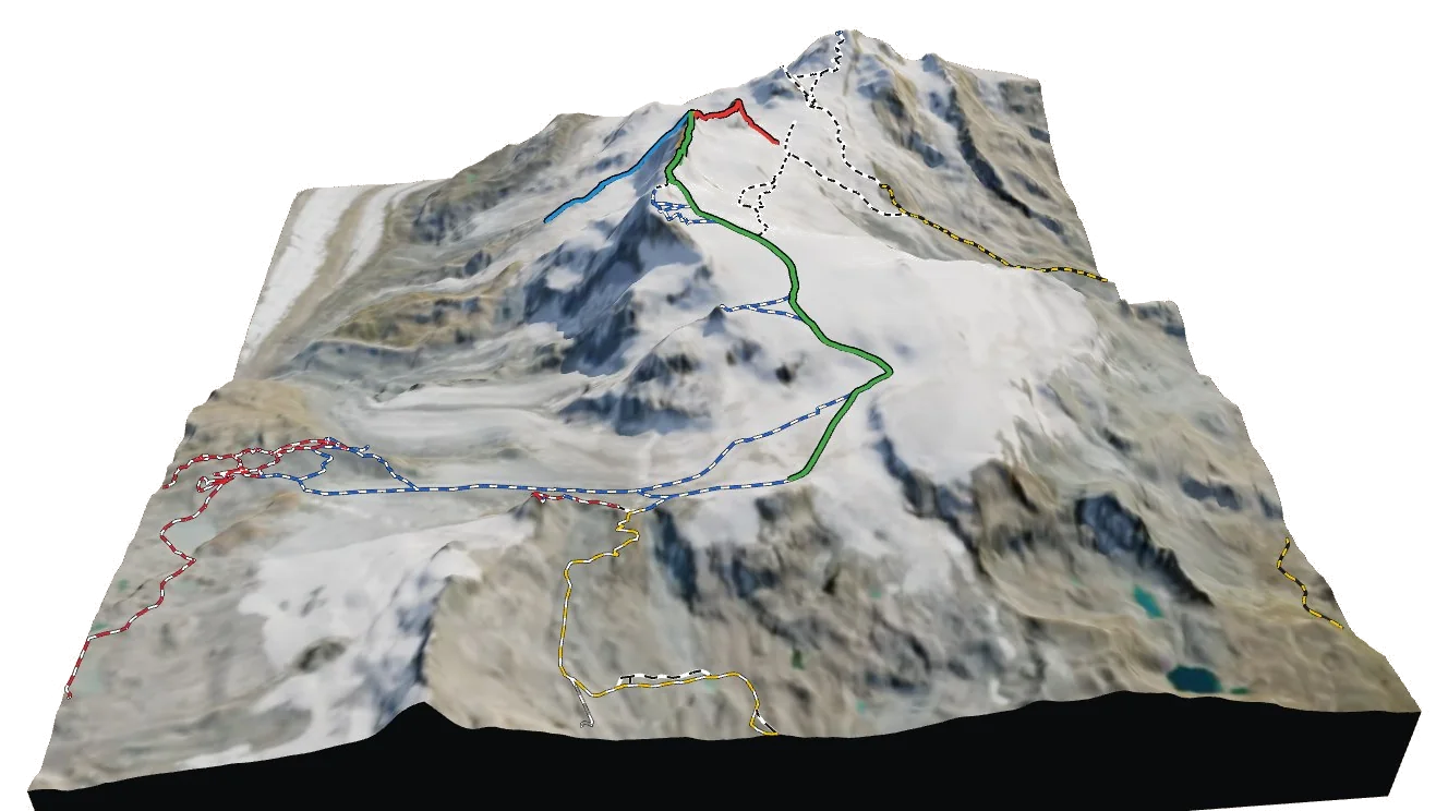
Overview
About Breithorn Orientale
Breithorn Orientale rises to 4,139 m in the Monte Rosa area of the Alps, and is also known as Ostgipfel and Westlicher Breithornzwilling. It is one of only 120 summits in the atlas above 4,000 m, and number 65 by height. The nearest village is Zermatt at 1,604 m, about 9 km away, which leaves roughly 2,535 m of height between the valley and the top. The easiest way up is the From the Rossi-Volante bivouac, graded PD+ with rock moves up to II. The hardest of the 4 listed routes is the ENE Ridge at TD-. 2 come from guidebooks; the rest are estimated from trails and terrain. Most parties spend a night at Bivacco Rossi e Volante (3,707 m), 0.9 km from the summit. 2 waymarked hikes start within 5 km, useful for acclimatising first.
Climbing
Routes to the summit
PD+
From the Rossi-Volante bivouac
Moderately difficult · rock up to II
Guidebook
Normal or classic line on this summit. Grade from current guidebooks; the line is traced from trail data and terrain, so check a guidebook for the exact way.
- Grade
- PD+ · rock II
- Time
- 2–3 h up (estimate)
- Height gain
- 389 m
- Starts from
- Bivacco Rossi e Volante
On the route
- Starts at Bivacco Rossi e Volante
- About 1.2 km and 389 m of ascent on the line shown
- Glacier travel: Grande Ghiacciaio di Verra
- Steepest sustained section about 39° (from the terrain model)
Tips
- Rope up on the glacier and carry crevasse-rescue gear
- Steep ground: crampons and ice axe likely needed early in the season
- Above 4000 m: acclimatise before the climb
- Check current conditions with the nearest hut or local guides before you go
AD-
Breithorn half traverse (from the West summit)
Fairly difficult · rock up to III
Guidebook
Normal or classic line on this summit. Grade from current guidebooks; the line is traced from trail data and terrain, so check a guidebook for the exact way.
- Grade
- AD- · rock III
- Time
- 4–5 h up (estimate)
- Height gain
- 863 m
- Starts from
- Rifugio Guide del Cervino
On the route
- Starts at Rifugio Guide del Cervino
- About 5.7 km and 863 m of ascent on the line shown
- Glacier travel: Grande Ghiacciaio di Verra, Ghiacciaio d'Aventina o di Ventina, Theodulgletscher
- Passes Passo di Ventina Nord (3443 m)
- Passes Selle (4022 m)
- Steepest sustained section about 54° (from the terrain model)
Tips
- Rope up on the glacier and carry crevasse-rescue gear
- Steep ground: crampons and ice axe likely needed early in the season
- Above 4000 m: acclimatise before the climb
- Check current conditions with the nearest hut or local guides before you go
AD
NNE Ridge
Fairly difficult · rock up to III
Estimated
The NNE ridge of Breithorn Orientale / Ostgipfel, traced from the terrain model to the col or ridge foot. No mapped trail follows it.
- Grade
- AD · rock III
- Time
- 3–5 h up (estimate)
- Height gain
- 869 m
- Starts from
- Chli Triftjisattel
On the route
- About 1.5 km and 869 m of ascent on the line shown
- Glacier travel: Breithorngletscher
- Passes Chli Triftjisattel (3489 m)
- Steepest sustained section about 50° (from the terrain model)
Tips
- Rope up on the glacier and carry crevasse-rescue gear
- Steep ground: crampons and ice axe likely needed early in the season
- Ridge line traced from the terrain model; check a guidebook for the exact line, cornices and gendarmes
- Above 4000 m: acclimatise before the climb
- No marked trail mapped here: route-finding skills required
- Check current conditions with the nearest hut or local guides before you go
TD-
ENE Ridge
Very difficult · rock up to V
Estimated
The ENE ridge of Breithorn Orientale / Ostgipfel, traced from the terrain model to the col or ridge foot. No mapped trail follows it.
- Grade
- TD- · rock V
- Time
- 1–2 h up (estimate)
- Height gain
- 418 m
- Starts from
- ridge foot at 3654 m
On the route
- About 0.4 km and 418 m of ascent on the line shown
- Steepest sustained section about 66° (from the terrain model)
Tips
- Steep ground: crampons and ice axe likely needed early in the season
- Ridge line traced from the terrain model; check a guidebook for the exact line, cornices and gendarmes
- Above 4000 m: acclimatise before the climb
- No marked trail mapped here: route-finding skills required
- Check current conditions with the nearest hut or local guides before you go
Alpine grades: F easy · PD moderately difficult · AD fairly difficult · D difficult · TD very difficult. Roman numerals give the hardest rock moves.
The 3D atlas
Don’t just read about Breithorn Orientale. Fly around it.
Every route on this page is traced on the real terrain in Berg Explorer. Spin the mountain, follow a ridge to the top and see which huts and lifts get you there.
- Turn and tilt every face in real 3D terrain
- Each route traced in colour, with its grade
- Huts, lifts and waymarked trails on the map
- Free, in your browser, no download
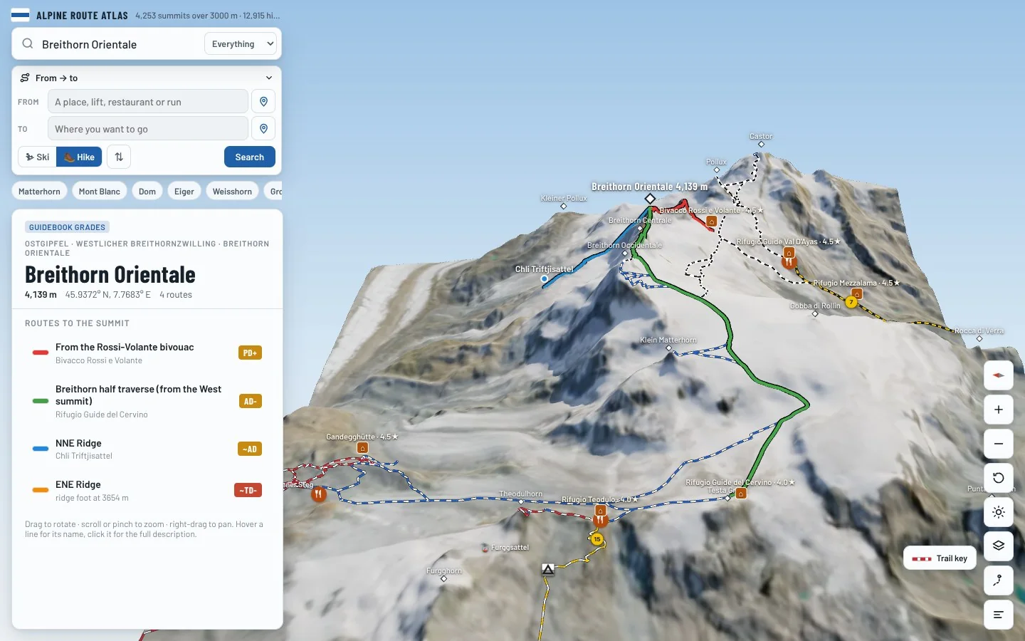
Where to stay
Huts for Breithorn Orientale
Nearby
Summits close by
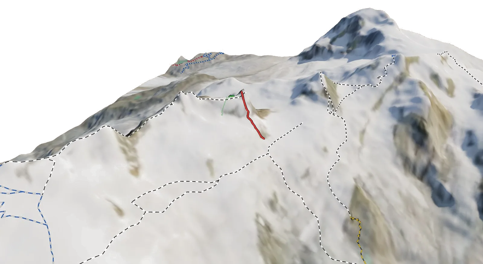
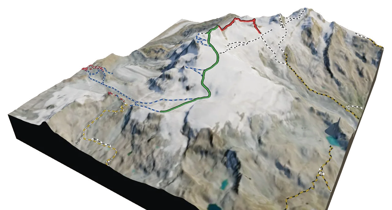
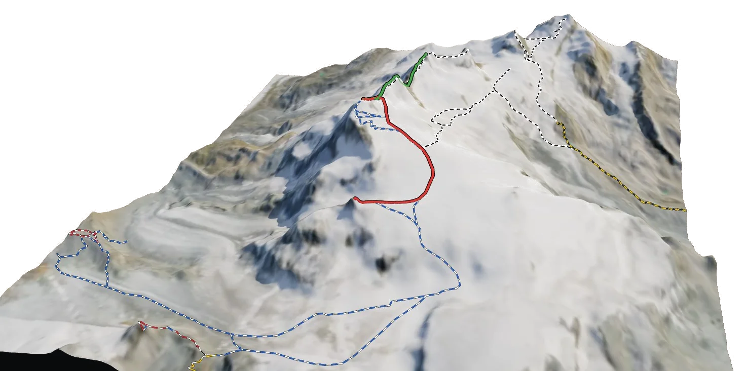
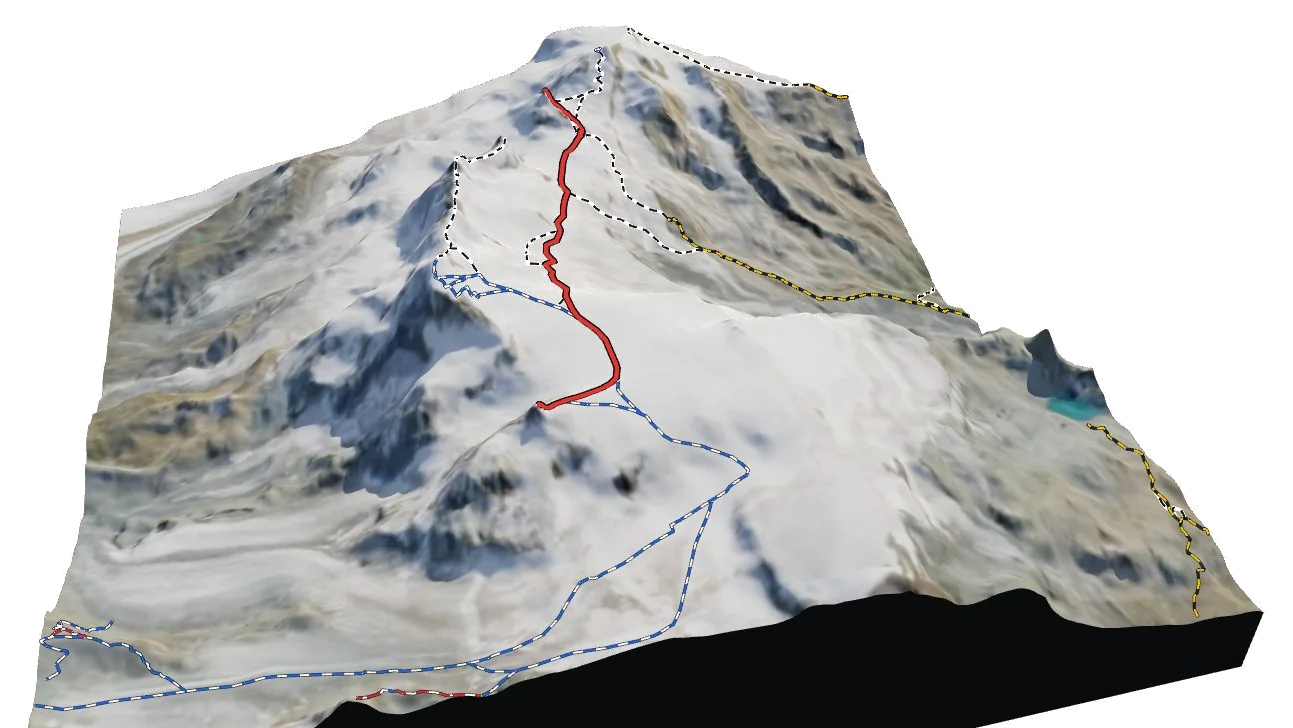
See Breithorn Orientale in three dimensions
Open the 3D atlas