
Bernese Alps · 4,042 m
Lauteraarhorn
2 routes to a 4,042 m summit in the Bernese Alps area, from AD (fairly difficult).
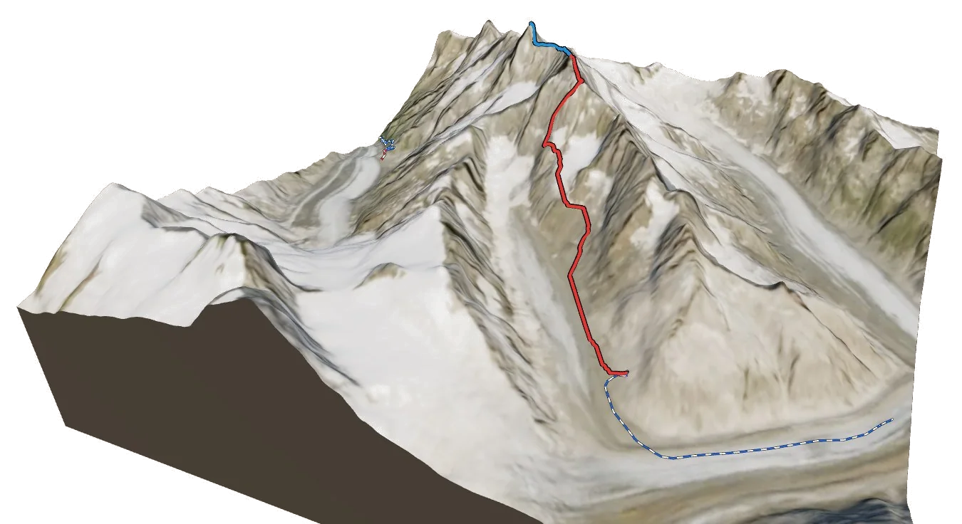
Overview
About Lauteraarhorn
Lauteraarhorn rises to 4,042 m in the Bernese Alps area of the Alps. It is one of only 120 summits in the atlas above 4,000 m, and number 101 by height. The nearest village is Grindelwald at 1,054 m, about 8 km away, which leaves roughly 2,988 m of height between the valley and the top. The easiest way up is the Normal Route (S Face Couloir and SE Ridge), graded AD with rock moves up to III, snow 45°. The hardest of the 2 listed routes is the Schreckhorn–Lauteraarhorn Traverse (Lauteraargrat) at D. All of them come from guidebooks. Most parties spend a night at Schreckhornhütte SAC (2,530 m), 2.3 km from the summit.
Climbing
Routes to the summit
AD
Normal Route (S Face Couloir and SE Ridge)
Fairly difficult · rock up to III, snow 45°
Guidebook
The usual way up: a long glacier approach from the Aar bivouac, a steep snow couloir in the south face to the Lauteraarjoch, then fine, solid rock on the SE ridge.
- Grade
- AD · rock III, snow 45°
- Time
- 5–7 h from the Aar bivouac
- Height gain
- 1,310 m
- Starts from
- Aarbiwak (2731 m), from the Grimsel Hospiz via the Unteraar glacier
On the route
- Long walk up the Strahlegg glacier from the Aar bivouac
- Traverse below the SW faces of the Klein Lauteraarhorn
- Steep snow couloir in the south face to the Lauteraarjoch (3915 m), about 45°
- SE ridge on solid rock, II–III
- Remote: one of the least climbed 4000ers
Tips
- Be in the couloir early, on frozen snow: avalanches here have been fatal when parties started too late
- The Aar bivouac is unstaffed: bring food, stove and sleeping bag
- Reach the bivouac from the Grimsel Hospiz along the Unteraar glacier (6–7 h)
- Carry a few ice screws for the couloir
D
Schreckhorn–Lauteraarhorn Traverse (Lauteraargrat)
Difficult · rock up to IV
Guidebook
One of the great Bernese ridge traverses: from the Schreckhorn down to the Schrecksattel and along the long, exposed Lauteraargrat to the Lauteraarhorn.
- Grade
- D · rock IV
- Time
- 12–16 h from the Schreckhorn hut
- Height gain
- 1,550 m
- Starts from
- Schreckhornhütte (2529 m), over the Schreckhorn
On the route
- Ascent of the Schreckhorn by its normal route first (AD+)
- Descent to the Schrecksattel (AD+)
- Long, exposed crest from the Schrecksattel to the Lauteraarhorn with pitches of UIAA IV
- Very long day; retreat options are few
Tips
- Only for fast, experienced parties in settled weather
- Descend by the Lauteraarhorn normal route to the Aar bivouac, or reverse to the Schreckhorn hut
- Start in the dark from the Schreckhorn hut
Alpine grades: F easy · PD moderately difficult · AD fairly difficult · D difficult · TD very difficult. Roman numerals give the hardest rock moves.
The 3D atlas
Don’t just read about Lauteraarhorn. Fly around it.
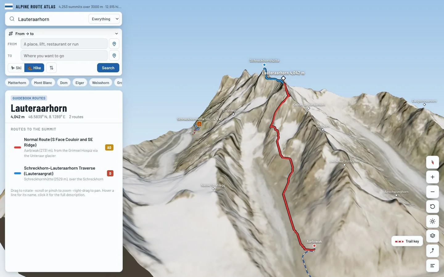
Every route on this page is traced on the real terrain in Berg Explorer. Spin the mountain, follow a ridge to the top and see which huts and lifts get you there.
- Turn and tilt every face in real 3D terrain
- Each route traced in colour, with its grade
- Huts, lifts and waymarked trails on the map
- Free, in your browser, no download
Where to stay
Huts for Lauteraarhorn
Nearby
Summits close by
Kleines Lauteraarhorn
3,738 m · 1.0 km
Schreckhorn
4,078 m · 1.0 km
Strahlegghorn
3,461 m · 1.2 km
Nässihorn
3,741 m · 1.7 km
See Lauteraarhorn in three dimensions
Open the 3D atlas